High Resolution Rice Maps for NE May Help Boost Production
-
Research Stash
- News
- 3.4K
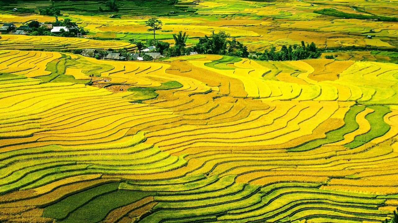
Mapping and monitoring of paddy cultivation areas are essential for making effective targeting strategies for the spread of new technologies, sustainable crop management and diversification options among rice-growing farmers. Recently scientists have developed high-resolution seasonal maps for Northeast India and Bangladesh to study cloud-prone rice paddy cultivation regions in South Asia.
Large scale paddy mapping at medium or high spatial resolution is rare, primarily due to limited availability of cloud-free optical imagery. The rice paddy maps, which are freely distributed by International Rice Research Institute, Philippines are of coarse spatial resolution and more than nearly seven years old.
Scientists from China have now developed high-resolution maps with crucial information, by using cloud-free Synthetic Aperture Radar images from Sentinel-1 satellite, the Random Forest classifier, and the Google Earth Engine cloud computing platform. The Sentinel-1 satellite was launched by European Space Agency and its data is available for free.
“We mapped rice growing areas accurately in India and Bangladesh using microwave satellite images. The knowledge of the spatial extent and rice cropping intensity is an asset to the government and other agencies for efficient land and water resources management along with environment sustainable growth to ensure food security for all the people in the world,” said Dr. Mrinal Singha of Chinese Academy of Sciences, Beijing.
The team studied three distinct rice cultivation seasons – Boro, Aus and Aman in Northeast India and entire Bangladesh. Boro rice is sown in winter and harvested in summer, while Aus rice is sown in summer along with pre monsoonal rains and harvested in autumn. And Aman rice is sown in the rainy season and harvested in winter.
The study area was divided into several levels like paddy rice, natural vegetation, water, built-up land, and others. Then random points were generated in each level and further categorized as circle buffers in the maps.
Researchers used backscatter signals from Synthetic Aperture Radar of Sentinel-1 as an indicator for tracking rice paddy growth. These backscatter values change with varying conditions of the three paddy rice stages – transplanting, vegetative and after-harvest. These stages provided distinct backscatter values that were utilized for remote sensing analysis.
“To meet the growing global as well as local demand for rice, production needs to be monitored and increased. These high-resolution rice maps would be very useful for assessment of rice paddy cultivation under clouded environment particularly in Northeast India where paddy cultivation usually starts in the rainy season,” commented Dr. Upendra Kumar, Scientist (Microbiology), National Institute of Rice Research, Cuttack, while speaking to India Science Wire. He was not associated with the study.
For this study, scientists selected computationally efficient random forest machine learning algorithm particularly to handle large satellite data for entire Bangladesh and Northeast India. Rice paddy maps were evaluated against independent validation samples, and compared with existing products from the International Rice Research Institute and the analysis of Moderate Resolution Imaging Spectroradiometer (MODIS) data. The resultant maps were validated using ground truth samples from multiple sources including field survey data and field photographs, visual interpretation with very high-resolution images and of Sentinel-2 visual images.
It was found that the Synthetic Aperture Radar-based mapping had three benefits – reduction of data acquiring and pre-processing time, a significant decrease in computational time, and the method could be quickly extended to larger regions.
It is proposed to extend the dataset to cover more countries in tropical Asia involving more detailed information. New versions would be periodically updated and uploaded to the repository upon the availability of new datasets.
The threat to paddy rice cultivation is increasing these days. The reasons are changing patterns of rainfall, global temperature rise along with rapid urbanization and industrialization. In this context, high-resolution rice paddy maps could be useful to researchers and findings beneficial to rice farmers. These maps can also be used to study regional food security, freshwater use, climate change, and transmission of avian influenza virus.
“In future, the maps produced in our study will help to assess or identify the flood-prone region particularly in the Brahmaputra basin areas to prevent production loss and minimize damage,” commented Jinwei Dong, another member of the research team.
The research team included Mrinal Singha and Jinwei Dong (Institute of Geographic Sciences and Natural Resources Research, Chinese Academy of Sciences), Geli Zhang (China Agricultural University), Xiangming Xiao (Center for Spatial Analysis, University of Oklahoma). The research finding has been published in the journal Scientific Data. (India Science Wire)
If you liked this article, then please subscribe to our YouTube Channel for the latest Science & Tech news. You can also find us on Twitter & Facebook.